Resilient Gowanus
Brooklyn, NY
Advised by Aniket Shahane
2023
In collaboration with Anna Reggio
In 2012, Hurricane Sandy caused extensive damage to Gowanus and Red Hook, with flood levels reaching as high as 18 feet in some areas. In addition to the destruction and damage of homes and businesses, the storm caused disruptions to vital services including power and water supply, healthcare, transportation, and telecommunications.
Flooding and power outage impacts on food retailers and food pantries left many residents, particularly residents of the Red Hook Houses, “without access to food within a reasonable distance.”
Additionally, Hunt’s Point, the distribution centre currently responsible for 50% of New York City’s food supply, relies primarily on truck transport. A 2017 report published by the New York State Department of Transportation called for the development of an outbound, waterborne transportation system for food to increase efficiency while decreasing traffic and emissions. The report strongly recommended that the implementation of this system start in Red Hook.
In light of this, our project asks: What if the Gowanus Canal supported food infrastructure in a manner that both mitigated the threat of flooding and provided robust connections for access between the neighborhoods of Gowanus, Red Hook, Park Slope and Carroll Gardens?
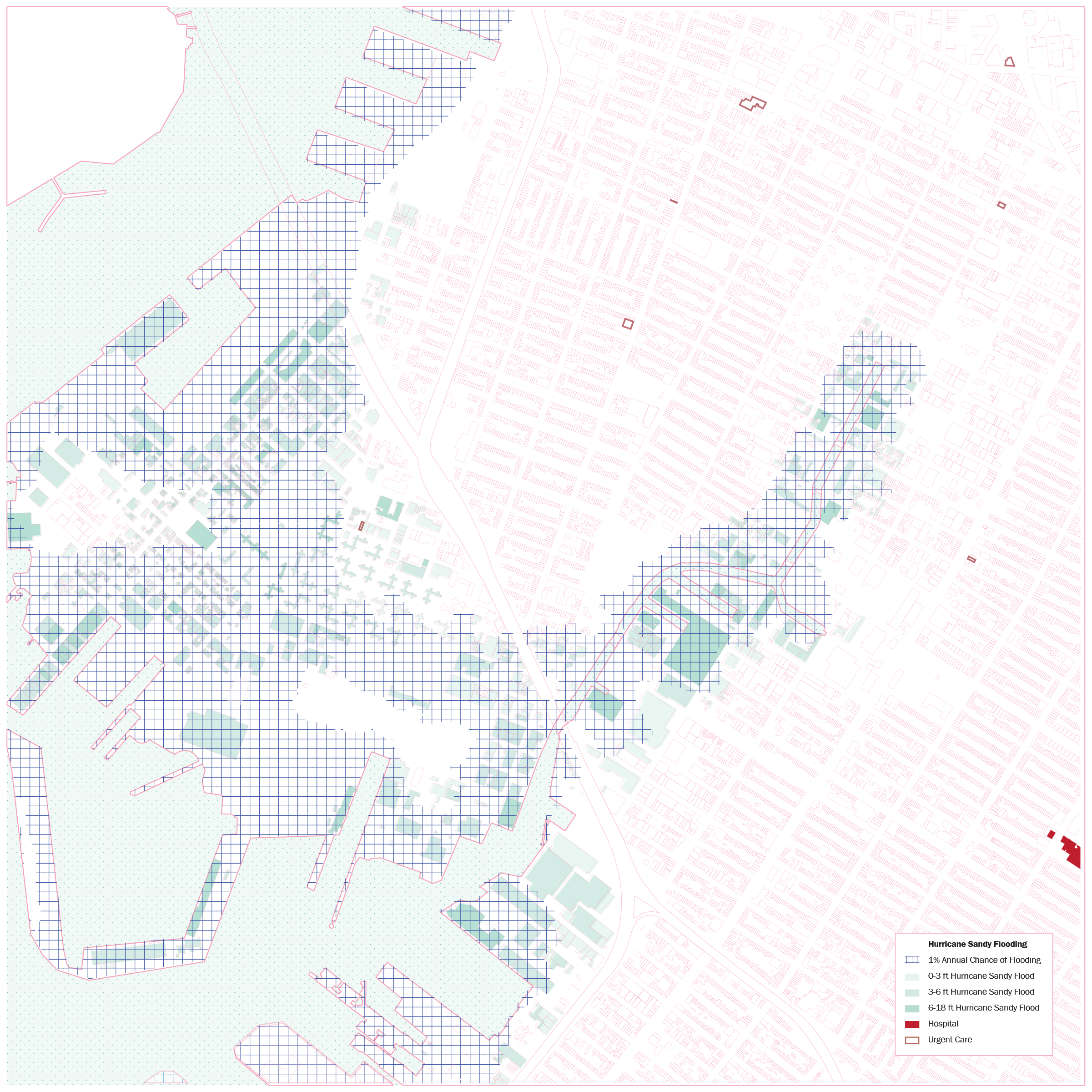

Our analysis began by identifying prevalent liabilities in the Gowanus neighbourhood that could be addressed through our project. Looking at the lots that were affected during Hurricane Sandy and FEMA projections, we found that areas in the canal’s historic basin and the reclaimed land in Red Hook were severely threatened by flooding. Additionally, the canal which once connected Gowanus to the rest of the region now divides the neighbourhood as there are few roads that cross the canal and even fewer pedestrian walkways. The Brooklyn-Queens Expressway exacerbates this lack of connection as Red Hook is isolated from the rest of Gowanus. Finally, upon looking at the supply of food in Gowanus and Red Hook, it became clear that not only are the neighbourhoods severely under-served, but also that they are only accessible by a limited amount of commercial truck routes.


Having identified these looming liabilities, we asked: What if the Gowanus was reactivated and redesigned as a watery urban street that provided access to new fresh food assets within the neighborhood, with new channels of cross-connection supporting pedestrian access while increasing flood and food resiliency?
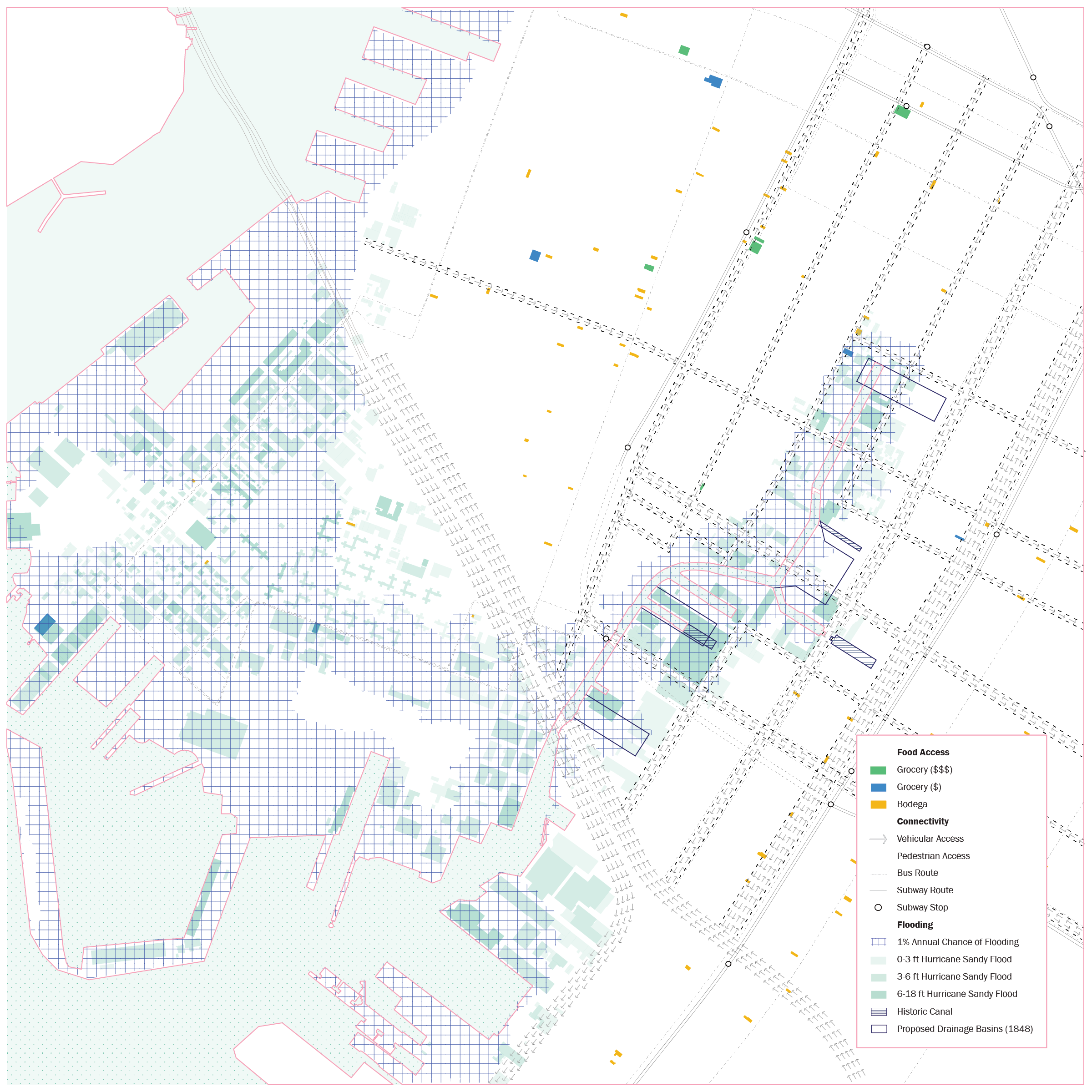

To make the canal productive whilst simultaneously minimising flooding, we proposed a new footprint for the canal based on FEMA flooding projections, historic canal routes, and earlier proposed drainage basins.
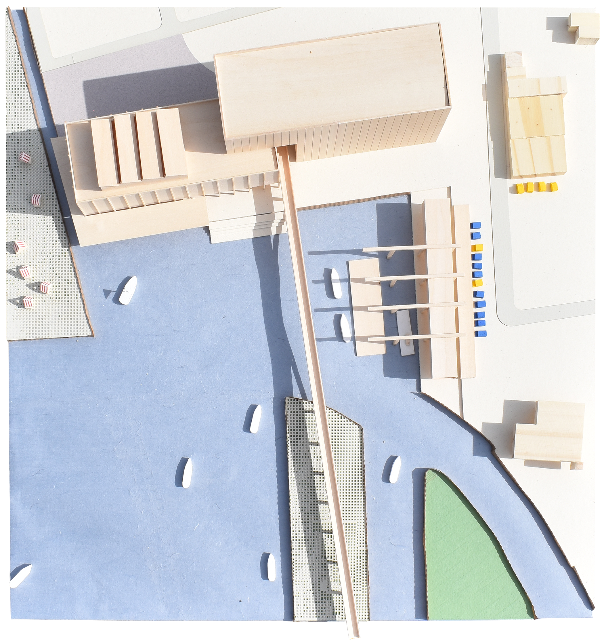
 The canal was re-imagined as a watery street that supports pedestrian access and inter-neighborhood connectivity while promoting flood resiliency through a patchwork of ground conditions informed by the Hurricane Sandy recorded flood levels. For instance, areas that flooded between 6 and 18 feet become floodable softscape, or floodable hardscape, which are accessible to pedestrians but can absorb, or catch and release water, in the event of flooding. Areas that flooded between 3 and 6 feet become porous lots, suitable for structures with floodable ground floors or elevated structures.
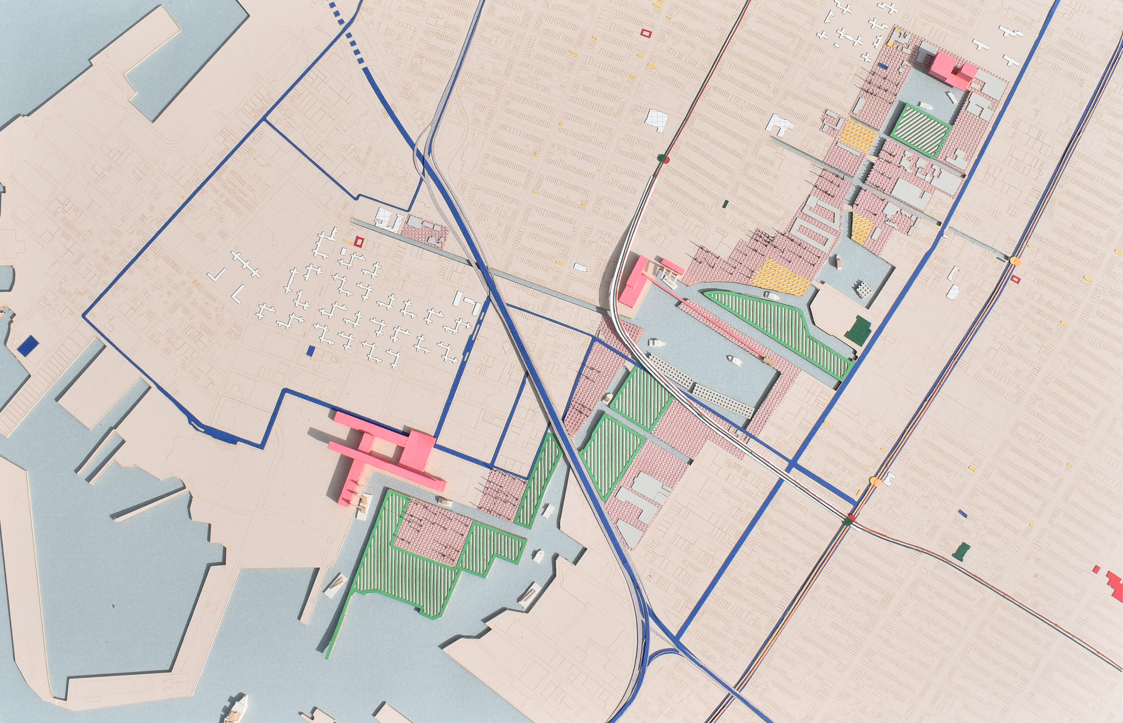
 Driven by the initial goal of increasing access to fresh food for the current residents of Gowanus, three new hubs along the canal support a new, marine-based network of food distribution and consumption. These hubs are operational during flooding events due to their strategic siting on canal-adjacent on higher ground.
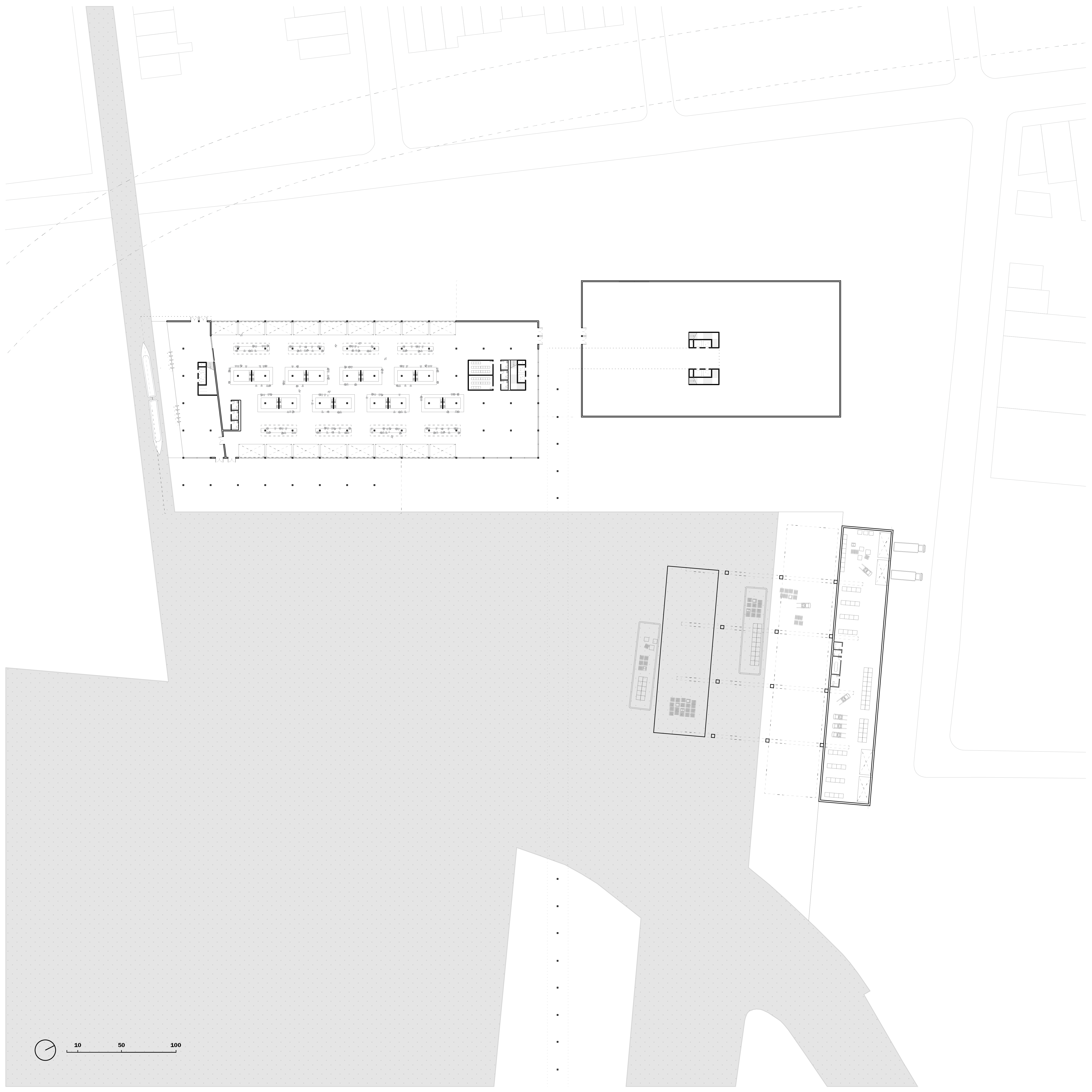
The hubs are scaled to accommodate their program and placement along the canal as a transportation vector. The largest hub is strategically located at the mouth of the canal serving as a receiving port for deliveries by both truck and primarily boat, from Hunt’s Point and farther up the Hudson River and Erie Canal, connecting Gowanus to the existing food networks in the city and larger region.
These deliveries are transferred to smaller boats and transported up the canal to the second hub, which is situated at the beginning of a new arm of the canal that extends into Red Hook, providing a marine storm evacuation route. The third hub at the head of the canal extends distribution to the Gowanus Houses and surrounding communities.


Part of the defunct and abandoned industrial land of Gowanus is converted into floodable softscapes with landscaping and elevated walkways to increase pedestrian access through the neighbourhood. This strategy also aims at partially restoring the area's estuary ecology.

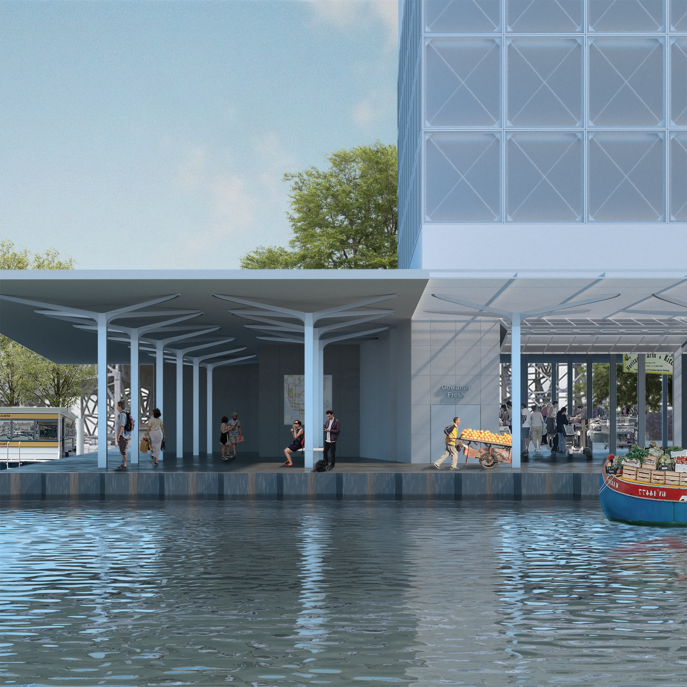
Zooming in to think through the spatial implications of the second (central) hub at an architectural scale, we imagine a port for receiving and storing fresh food delivered by boat and distributed by both boat and truck. The food delivered on site could not only supply a market hall that serves the community on a daily basis, but could also become an emergency food distribution hub in the next major storm event.